Experts Explain | What the UN sea level declaration means for the world — and India’s eroding coast
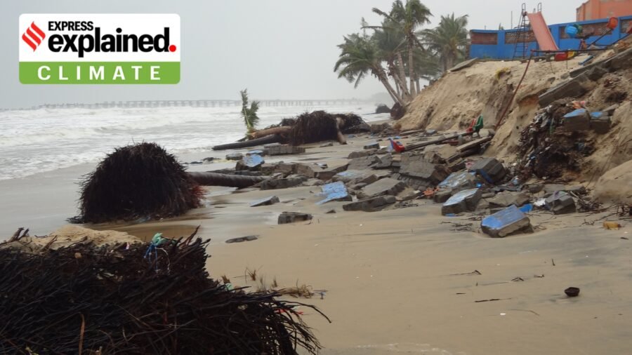
If emissions keep climbing, the brief puts the figure at about 77 cm. The brief says the sea will keep rising for centuries to millennia even if the world reaches “net zero”.
Amid these scenarios, the declaration focuses on the loss of territory faced by vulnerable countries — such as the island nations of Tuvalu and Kiribati in the Pacific, as well as the Maldives. Importantly, it also asks nations to build sea-level rise projections into the planning and design of their coastal infrastructure — which is where India has work to do. Let us look at both aspects.
Can a country retain its statehood even if it loses its territory?
Under the 1933 Montevideo Convention, a State is defined using four main criteria: a permanent population, a defined territory, a government and the capacity to enter into relations with other states.
Story continues below this ad
But if rising sea levels swallow a State’s “defined territory”, or render it uninhabitable for a “permanent population”, does it still remain a state? This is the question the UN declaration attempts to settle. Indeed, it affirms that a country stays a country when the sea takes its land.
The declaration mentions a “presumption in favour of continued statehood”, so such a country keeps its sovereignty, its rights and its seat at the UN.
Crucially, such a country would also keep its nautical boundaries — which are calculated from the coast — even when the coastline retreats. These include the sovereign waters of the ‘territorial sea’ that extends 12 nautical miles (around 22.2 km) from the coast and the larger ‘exclusive economic zone’ of up to about 370 km from the coast in which a country has exclusive rights over natural resources.
Story continues below this ad
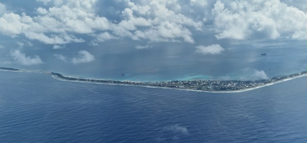 An atoll (or island) of the archipelagic country of Tuvalu in the Pacific Ocean. (Wikimedia Commons)
The declaration calls adaptation and mitigation action “essential”, but leaves the negotiation of emission cuts to the UN climate convention and the Paris Agreement.
For people who lose their homes, the declaration asks countries to respect their human rights and to “encourage strengthened international cooperation to assist persons affected”. It also supports voluntary choices for communities and “mobility with dignity”.
One example of this is already underway. By December 2025, more than a third of Tuvalu’s 11,000-strong population had applied for climate visas to migrate to Australia under a bilateral treaty.
What does India gain from a promise for small islands?
Story continues below this ad
At the meeting, Sibi George, Secretary (West) in the Ministry of External Affairs, welcomed the declaration and backed stable maritime zones and continuity of statehood.
He also reaffirmed equity and “common but differentiated responsibilities and respective capabilities”, the principle that every country must act on climate change, while those that caused more of it and can afford more should do more.
India has its own stake in the text. A 2023-24 remeasurement counts 1,298 offshore islands and islets and a coastline of 11,098 km. Lakshadweep and the Andaman and Nicobar Islands carry India’s boundaries at sea far into the Arabian Sea and the Bay of Bengal. So, a pledge to keep those nautical boundaries fixed, as mentioned above, protects India’s waters as well as the Pacific’s.
Story continues below this ad
The vote also continues India’s work with island nations, from the Forum for India–Pacific Islands Cooperation, set up with 14 Pacific countries in 2014, to the Infrastructure for Resilient Island States initiative India launched at the Glasgow climate summit in 2021.
Is India’s own coast ready?
The government’s National Centre for Coastal Research tracked the whole mainland shoreline between 1990 and 2016 and found that about a third of it was eroding.
Nationally, the losses and gains are roughly balanced, with 234 sq km lost to erosion and 231 sq km gained elsewhere. The losses, however, are concentrated: the assessment finds nearly 400 km of coast retreating by more than 5 metres a year, and another 225 km by 3 to 5 metres. West Bengal alone has more than 170 km in the fastest category, about a third of its coast.
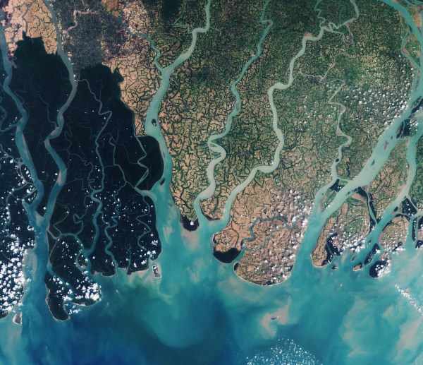 A satellite view of the Sundarbans. (Wikimedia Commons)
Under the 2019 Coastal Regulation Zone notification, the strip where nothing new may be built is 50 metres wide in densely populated rural areas once a state’s coastal plan is approved, and 200 metres elsewhere. Both are measured from the high-tide line — which the notification defines as the line the highest spring tide reaches today.
Story continues below this ad
By our arithmetic, on a stretch losing 5 metres a year, a house approved 50 metres from today’s high-tide line would stand at the water’s edge in about ten years if the retreat continues. Even a 200-metre strip would last about 40 years.
The Survey of India has mapped a better line, a hazard line, that takes in sea level rise and shoreline change, and it has been shared with the coastal states. The 2019 rules use it as “a tool for disaster management plan” and for land-use planning, while the no-build strip is still measured from today’s tide. The declaration India supported recognises the need to build sea-level projections into the planning of coastal infrastructure.
Who does the declaration leave out?
In the Sundarbans, the loss has already happened. According to India Water Portal, Ghoramara island shrank from about 7.2 sq km in 1972 to 3.6 sq km in 2022. Families who had moved there from neighbouring Lohachara, which disappeared in the early 2000s, were displaced again within a decade, and those relocated were moved to marginal land without secure tenure or livelihood support.
Indian law has no clear category for people who lose land gradually to erosion, so each relocation is decided case by case. A 2025 review in Frontiers in Marine Science estimates that 45 million Indians will be at risk from sea level rise by 2050 and notes that India “still lacks comprehensive legislation” to deal with these risks. Fiji has shown one way: It wrote planned relocation into its Climate Change Act in 2021, with a trust fund to pay for it.
What should India do before the UN meets again?
Story continues below this ad
The declaration schedules another high-level meeting on sea level rise by September 2030, which gives India four years to show results.
It can start by measuring the no-build strip from the hazard line, or widening it by the local erosion rate, beginning with the stretches the National Centre for Coastal Research shows retreating fastest.
It also needs a law for people displaced slowly by erosion and rising water, one that gives relocated families land title and livelihood support at the new site.
And it should keep pressing on money. The declaration calls for scaled-up finance and “timely and predictable disbursement”. The UN Environment Programme puts developing countries’ adaptation needs at over $310 billion a year by 2035, against $26 billion of international public adaptation finance in 2023. At the Baku climate summit in 2024, India objected to the new goal of $300 billion a year by 2035 as “too little and too distant”. It should press the same case at COP31 in Antalya in November.
Story continues below this ad
In New York, India backed the principle that boundaries at sea should hold while the shoreline moves. At home, the same declaration asks it to plan for that moving shoreline.
Singh is Director, Science, Gateway Research Foundation, and Agarwal is Senior Fellow at the Institute for Governance & Sustainable Development.


‘110 kgs at 34’: Delhi gastroenterologist, now 74 kilos, opens up about drastic weight loss
By Sohail Khan · 30 Sep
In Fort Kochi, a blaze eats into a Jewish legacy: what the Koder House held
By Sohail Khan · 30 Sep
Leave a Reply