Aravallis can’t be defined by 1 yardstick: Supreme Court panel seeks extension
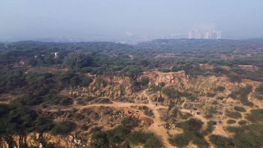
Cautioning against releasing premature area estimates, a High-Powered Committee (HPC) constituted by the Supreme Court has said the Aravalli hills and ranges cannot be scientifically delineated using a single terrain-based yardstick. Instead, it has proposed an ecosystem-based framework that considers forests, water systems, biodiversity, landscape connectivity, and livelihoods.
In a compliance report submitted to the top court on August 31, the Committee sought a six-month extension, until February 28, 2027, to complete a transparent, reproducible, and scientifically defensible assessment. Its proposed “Aravalli Ecosystem Landscape” framework would treat the Aravallis as an interconnected ecological system rather than merely a collection of individually identifiable hills.
The panel said numerical estimates carrying potentially significant regulatory and socio-economic consequences should be released only after the underlying datasets, methodology and analytical parameters have been tested and independently validated.
During November-December 2025, a series of investigations by exposed how an SC-appointed committee headed by the Environment Secretary ignored the Forest Survey of India’s (FSI) warning that a 100-metre height threshold would exclude nearly 90 per cent of Aravalli hills, overlooked objections raised by the Central Empowered Committee (CEC), and disregarded the SC’s own rejection of the 100-metre benchmark in 2010.
Subsequently, the SC’s amicus curiae in the Aravalli definition case also informed the court in writing that the October 2025 report had “completely suppressed” the FSI’s views while recommending a 100-metre definition for the hills.
On December 29, 2025, the SC put the implementation of the Environment Ministry’s October 2025 report on hold and underscored the need for an HPC of domain experts to undertake a comprehensive review. Subsequently, the HPC was constituted in May 2026 to examine the definition, delineation, conservation and management of the Aravallis and file its report by August 31.
Why a single terrain test won’t work
In its report, the HPC said its work had demonstrated that the questions before it could not be addressed through a single terrain criterion. A robust assessment would have to account for the resolution of digital elevation models, spatial scale, analytical parameters, and validation procedures, in addition to ecological and socio-economic evidence.
Story continues below this ad
The panel is comparing the methodology recommended in October 2025 by the Committee for Uniform Definition of Hills and Ranges of Aravalli with an earlier approach developed by the Forest Survey of India in 2010.
The feasibility of the comparative exercise has been demonstrated in three sample districts — Alwar, Ajmer and Udaipur. The HPC now proposes to extend it across the Aravalli landscape using the Copernicus 30-metre digital elevation model and thematic layers such as district resource maps. Selected areas may also be analysed using higher-resolution CartoDEM data.
The panel said the results required further scrutiny and validation by institutions such as the National Remote Sensing Centre and the Indian Space Research Organisation. Changes in datasets or processing parameters could alter estimates of the area and number of hills, with major implications for conservation, regulation, mining and livelihoods.
The proposed Aravalli Ecosystem Landscape framework would combine the core hill system with recorded forests, protected areas, sacred sites, Orans and traditional pastures, wetlands, critical catchments, groundwater-recharge zones and archaeologically significant areas. Where relevant, it would also examine ecological links between the Aravallis and the adjoining Vindhyan hill systems.
Story continues below this ad
A composite index based on multiple factors could eventually be developed to identify areas with differing socio-ecological characteristics and guide differentiated conservation and management measures. The HPC will also examine whether existing regulatory provisions adequately protect these areas.
A connected ecosystem
According to the report, a rapid field assessment conducted between August 6 and 11 found that much of the Aravalli constitutes a connected landscape of small and large ridges with interlinked ecological, hydrological, biodiversity, and socio-cultural values. Even isolated hills and hillocks, the panel noted, could possess independent ecological, hydrological, aesthetic or cultural significance.
As of August 26, the HPC had received about 680 electronic and physical representations from farmers, pastoralists, local communities, residents, civil society organisations, statutory bodies, and mining-sector stakeholders.
The submissions raised concerns over mineral mining, stone quarrying, stone crushing, and unregulated sand mining, and their impact on drainage systems, water and air quality, public health, and biodiversity. They also highlighted tribal and community interests, agriculture, settlements, conservation priorities, mining-dependent livelihoods, and lessons from regulatory approaches adopted in the Western Ghats.
Story continues below this ad
The HPC said additional consultations and field assessments were necessary to cover groups and areas not adequately represented during its initial exercise. It will also study urbanisation, mining-related degradation, wildlife corridors, aquifers, watersheds, ecosystem services, and land-use changes before arriving at its final recommendations.

Indian Railways plans to improve onboard waste management on trains – here’s how
By Sohail Khan · 4 Sep
After Nepal disaster, Sikkim faces flood risk; 40-high risk glacial lakes identified
By Sohail Khan · 4 Sep
Leave a Reply