Air quality management body to re-test burnt area protocol as satellite, ground data diverge
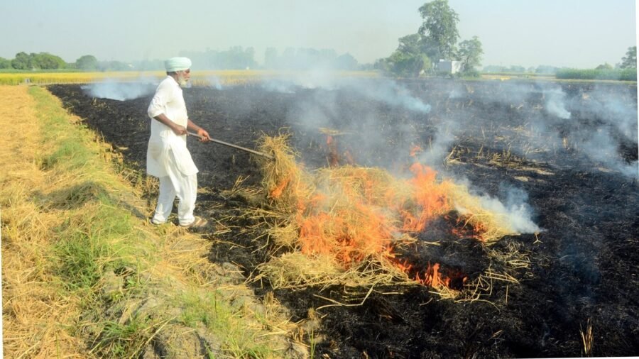
The Commission for Air Quality Management (CAQM) has not yet validated its ‘burnt area’ assessment protocol as significant divergence has emerged between satellite-based readings and on-ground verification for Punjab and Haryana.
The CAQM measures the extent of area burnt to manage crop stubble.
To resolve this difference, as per the official response to an RTI query and CAQM officials, the CAQM and the National Remote Sensing Centre (NRSC) under the Indian Space Research Organisation (Isro) will test the protocol once again in the upcoming Kharif harvest season.
Paddy stubble burning
Paddy stubble burning in the September 15-November 30 period is one of the major sources of air pollution in Delhi-NCR. On some days in October or November, emissions from farm fires account for up to 35 per cent of pollution. The CAQM, in collaboration with bodies under the Agriculture Ministry, monitors active fire counts. However, since 2024, the undercounting of these fires due to limitations of satellite overpass windows has been under scrutiny, including in the Supreme Court.
The burnt area assessment has been used as a tool to plug gaps left by the satellite’s overpass timings. However, ground truthing of the burnt area mapping carried out in the 2025 Kharif harvest and 2026 Rabi season has shown divergence.
“After the burnt area assessment began, we also incorporated ground truthing in the 2025 Kharif harvesting season and 2026 Rabi harvesting season to verify the burnt areas mapped through satellites. Improving this will further help in understanding the emission load and the intensity of the fires, leading to better enforcement,” said a CAQM official requesting anonymity.
“We are in talks with Isro to have better ground-truthing protocols,” the official added.
Response to RTI query
Story continues below this ad
In response to an RTI query seeking data on the burnt area mapped during the 2025 Kharif harvest and 2026 Rabi harvest season, CAQM said, “The Burnt Area Assessment protocol is under validation for further improvement. Although it has the potential to enhance monitoring efforts and align with the Standard Protocol for satellite-based estimation of crop residue burning, it is still undergoing validation. Once the methodology is fully established, it may help strengthen future action plans and enforcement actions.”
The burnt area assessment protocol was developed by the NRSC and Isro, along with a team from the Indian Agricultural Research Institute (IARI) and Punjab and Haryana’s State Remote Sensing Centres, using satellite data from the European Space Agency’s Sentinel-2. As per information obtained under RTI, the assessment protocol uses a Mid-Infrared Burn Index (MIRBI) method to detect burnt areas at a 20m x 20m spatial resolution at 5-7-day intervals, allowing fine-scale mapping of burnt residue patches across agricultural fields.

BRS leader KTR briefly detained during protest against Congress in Telangana
By Sohail Khan · 7 Sep


Leave a Reply