When will El Nino hit California? Forecast for San Diego, LA and other cities
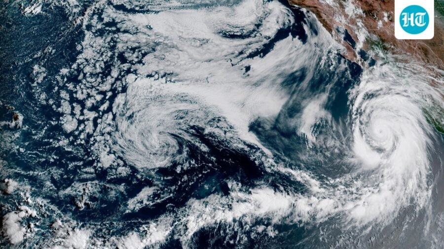
A record-strength El Nino is already here, and forecasts say California could see much more rain from December.
Published on: Sep 22, 2026, 03:50:09 IST
Prefer HTon Google
Share via
Copy link
California is preparing for a potentially historic El Nino, which is already showing record-breaking strength. Scientists say the event could have a major effect on the state's winter weather, with a higher chance of heavy rain, storms and flooding.
As per SF Chronicle, the 2026-27 El Nino is close to record territory. Scientists are now more sure that it will have a big effect on California rain and snow.
When will rain come?
According to the SF Chronicle, the North American Multi-Model Ensemble forecasts above-normal rain across California from December through April.
The European Center for Medium-Range Forecasts says San Francisco and other parts of California could get twice as much rain as normal from December through at least February.
Some of the models predict drier conditions, but most of them show above-normal rainfall.
Emily Becker, a seasonal prediction expert at the University of Miami, said winter rain forecasts are unlikely to change much until November, as per the SF Chronicle. She said other weather patterns cannot be predicted more than a few weeks ahead. However, this very strong El Nino could reduce the influence of those other weather patterns.
Why California could get so much rain
According to the SF Chronicle, the location of the warm water in the Pacific plays an important role. El Nino events with the warmest water near South America are more strongly linked to heavy rain in California than those with warm water in the middle of the Pacific.
John O'Brien, a climate scientist at the Heising-Simons Foundation, said, “The odds of an average winter are very low.”
When the water near South America is unusually warm, thunderstorms become stronger in the eastern Pacific. This can push the jet stream in a way that sends more moisture toward California. If the thunderstorms move west, the jet stream moves north over Oregon and Washington state.
Right now, the warmest water is near South America. The same pattern was seen during the strong El Nino events of 1982-83 and 1997-98, when California received huge amounts of rain.
In those years, "California just got smacked all up and down the state," O'Brien said.
This year, the warm water is even farther east and could stay there through the winter.
However, two other very strong El Nino events, in 1991-92 and 2015-16, were drier in California. During those events, the warm water was located more toward the middle of the Pacific.
"There's nothing to suggest right now (El Nino) is going to start migrating westward," O'Brien said, according to the SF Chronicle.
This could mean California may see a much wetter-than-normal winter.
Which California cities could be worst hit?
The cities most at risk from this historic El Nino cycle are concentrated along California’s coast and in areas prone to flooding and landslides. Los Angeles and San Diego are expected to face a higher risk of extreme rainfall.
Emergency planners and researchers at the Scripps Institution of Oceanography told ABC News that coastal communities including Malibu, Seal Beach, Oceanside, Encinitas, Carlsbad and Del Mar could face a dangerous mix of high surf, beach erosion and unusual sea-level changes.
Farther inland, areas such as downtown Los Angeles, San Francisco, Santa Rosa and Chula Vista could face flash flooding. Hillside communities such as Monrovia may also be at risk of mudslides and debris flows if powerful atmospheric rivers bring heavy, sustained rain.
Governor declares state of emergency
Gavin Newsom declared a state of emergency on Monday. The order is meant to bring supplies to communities before the extreme weather. It also gets the national guard ready to help with flood response and search and rescue. State agencies have been told to prepare roads and key infrastructure.
Newsom said in a statement that the order gives “[give] communities the support they need, [give] first responders the tools to do their jobs, and [give] families the confidence that their state is ready.”
As per The Guardian, the governor's office said there is a more than 90% chance of a very strong El Nino this year and a 75% chance of one of historic strength. This could bring heavy rain, floods, landslides and coastal flooding that cuts off neighborhoods. It could also cause widespread power outages.
What is El Nino?
El Nino is a natural climate pattern that happens when ocean temperatures in the central and eastern tropical Pacific become warmer than normal. This warming can change winds, rainfall and storm patterns around the world.
See Less

Lebanon needs international force after peacekeepers leave, PM tells UN chief
By Sohail Khan · 22 Sep
US torpedo test-fired from UK sea drone for first time: London
By Sohail Khan · 22 Sep

Leave a Reply