When dam gates must open: Kerala’s data-integration challenge for flood control
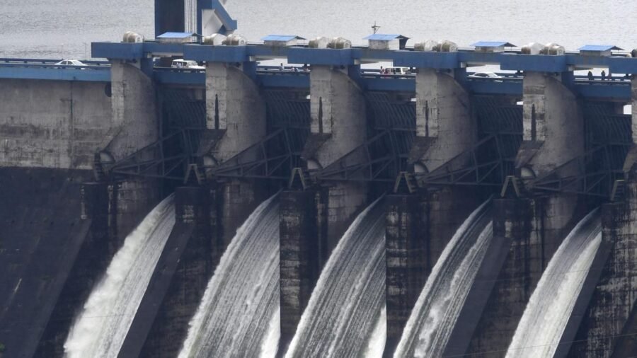
At the height of an extreme rainfall event, an officer managing a Kerala reservoir may have to decide whether or not to release water, when to do it, and how much quantity to be let out. The reservoir level is on the screen before him. But much of the other information relevant to that decision may be held in different systems by different institutions.
That, in one image, captures an important part of Kerala’s flood-management challenge. The question is increasingly not whether or not the State has data, but can the right pieces of data come together quickly enough to support the right decision.
Kerala has considerably greater monitoring capability than it did in 2018. The Kerala State Disaster Management Authority (KSDMA) reported 100 automated weather stations operational by December 2025. The Centre for Water Resources Development and Management (CWRDM) has developed the Reservoir Assessment Tool-Kerala, using satellite-derived storage estimates and modelled inflows to provide near-real-time reservoir information. The Kerala State Electricity Board (KSEB) and the Water Resources Department maintain reservoir and discharge data; the India Meteorological Department provides weather and rainfall forecasts; and the Indian National Centre for Ocean Information Services forecasts waves, currents, swells, and tides.
The information exists. The larger challenge is interoperability.
Lessons from 2018
The 2018 floods demonstrated why a river basin must be understood as a connected system. Extreme rainfall was the principal driver, but what happened downstream depended on the volume of run-off, reservoir conditions, tributary flows, and the capacity of rivers, lakes and outlets to carry the accumulated water.
The Central Water Commission’s study of the 2018 floods provides a striking example. During August 15-17, it estimated that approximately 1.63 billion cubic metres (BCM) of run-off was generated by the Pamba, Manimala, Achenkovil and Meenachil river systems, against an estimated carrying capacity of about 0.6 BCM in Vembanad Lake. The CWC also identified the then discharge capacity of the Thottappally spillway — about 630 cubic metres per second — as a major constraint. Around one BCM of the run-off remained, contributing to rising water levels in the lake and surrounding areas.
The State Water Resources Department notes that Thottappally was designed for a discharge of about 1,800 cubic metres per second, but siltation in the downstream channel can reduce its effective capacity substantially.
The lesson is important: a release that appears manageable at a reservoir cannot be assessed in isolation from conditions many kilometres downstream. Water does not recognise departmental boundaries.
From databases to a decision network
Kerala may, therefore, need not go for another standalone portal or database, but a secure interoperability layer connecting the systems it already possesses.
Such an architecture need not take ownership of the underlying data. Individual agencies could continue to own and operate their sensors, models, and databases. A read-only integration layer could instead map the relationships among them in machine-readable form.
Which rainfall stations feed which catchment? Which catchment feeds which reservoir? Where will a release travel? What other flows will join it? Which settlements and critical infrastructure lie downstream? What is the current carrying capacity of the river and its outlets? What will coastal conditions be when the water reaches the sea?
Every input should retain its source, timestamp and confidence level. Hydrological and hydraulic models must remain scientifically validated, and institutional responsibility clearly assigned.
Modern data architectures, knowledge graphs, and carefully governed artificial intelligence make such integration increasingly feasible. But AI should come last, not first. Without trusted data and validated relationships, AI merely processes uncertainty faster.
Technology must also address an institutional problem. Sharing operational information across departments raises legitimate questions of ownership, reliability, accountability and liability. A properly designed system can help by maintaining an auditable decision trail: what information was available at a particular moment, which models were consulted, what warnings were generated and why a particular recommendation emerged.
Such a record improves accountability, but it can also protect an officer who made a reasonable, evidence-based decision under difficult conditions.
The objective should never be to hand control of dam gates to a machine. Statutory authority and responsibility must remain with designated officials. Technology should give them a better common operating picture.
Start with one basin
Kerala need not attempt a State-wide system immediately. The Pamba basin offers a logical test bed because it contains many of the relationships such a system must understand: high-range rainfall and catchments, reservoirs, downstream river reaches, low-lying Kuttanad, Thottappally and finally the sea.
The KSDMA, Water Resources Department, KSEB, CWRDM and relevant meteorological, oceanographic and technology institutions could jointly build and independently validate a limited pilot.
Its test should be practical: if a specified quantity of water is released from a reservoir now, where will it travel, when will it reach critical locations, what other flows will it encounter, and what will the downstream and coastal conditions be when it arrives? Can every answer identify its source and level of confidence?
If such a pilot works, it can be extended basin by basin. If it fails, its weaknesses will have been discovered before committing the State to a large technology programme.
Kerala already has scientific institutions, sensors, forecasts, reservoir information, computing capability, and experienced administrators. Its next technological leap in flood management may therefore be less about producing more data than about making the data it already possesses work together.
As extreme weather becomes more unpredictable, that distinction may become increasingly important.
Ameer Ahamed is the founder of the Manappat Foundation involved in the 2018 flood rehabilitation work through the Paravoor Punarjani Project

Don’t buy a lab-grown diamond before checking these 7 things
By Sohail Khan · 29 Sep
Towards a gender just Uniform Civil Code
By Sohail Khan · 29 Sep
Essar eyes $18-billion US steel plant: Why Indian firms are investing in US amid tariffs
By Sohail Khan · 29 Sep