Hurricane Polo intensifies to Category 5 storm: 5 key things to know about Mexico threat, rainfall and more
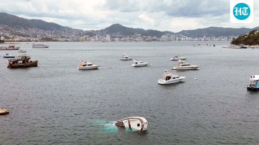
Hurricane Polo has reached Category 5 status with winds near 180 mph, posing risks of heavy rain and mudslides in Mexico.
Published on: Sep 23, 2026, 12:50:55 IST
Prefer HTon Google
Share via
Copy link
Hurricane Polo has rapidly intensified into a rare Category 5 storm in the Pacific Ocean, with the US National Oceanic and Atmospheric Administration (NOAA) warning of an “extremely dangerous” system capable of bringing torrential rain, flooding and mudslides to parts of Mexico.
The storm was packing sustained winds of nearly 180 mph (285 km/h) after a Hurricane Hunter aircraft flew into it on Tuesday.
Here are five key things to know about Hurricane Polo.
1. Polo has reached the highest hurricane category
Polo has intensified into a Category 5 hurricane, the highest level on the Saffir-Simpson Hurricane Wind Scale. NOAA’s National Hurricane Center described the storm’s intensification over a 24-hour period as “truly remarkable”.
Data collected by the Hurricane Hunter aircraft showed sustained winds of about 180 mph, with stronger gusts recorded. Polo is the third Category 5 storm of the season, according to the BBC report.
2. Hurricane Polo is not expected to make landfall
Despite its strength, Polo is forecast to skirt Mexico’s southwestern coast rather than make a direct landfall.
Mexico President Claudia Sheinbaum said there was no indication of a direct landfall but urged residents along the Pacific coast to remain vigilant.
The Mexican states of Jalisco, Colima and Michoacan were identified as areas at risk from the storm’s effects.
3. Heavy rain, flooding and mudslides remain a major threat
Polo’s slow movement could bring significant rainfall to parts of Mexico’s southwestern coast even without a direct landfall.
NOAA forecast rainfall totals of up to 6 inches (15cm), with some areas potentially receiving as much as 8 inches.
The rainfall could trigger deadly flooding and mudslides, while large ocean swells and life-threatening surf conditions were also expected over the following days.
4. Extremely warm Pacific waters are fueling the storm
One of the key factors behind Polo’s rapid strengthening is the unusually warm ocean surrounding the storm.
The developing El Niño climate phenomenon has produced exceptionally high sea-surface temperatures in parts of the Pacific. Warmer water provides additional energy that can allow tropical storms to strengthen and produce higher wind speeds.
NOAA said conditions around Polo remained “very conducive” to further intensification, with the storm potentially staying at Category 5 strength for several days.
5. El Niño is showing record-breaking ocean temperatures
Scientists monitoring the Pacific say the current El Niño is now the strongest on record based on daily sea-surface temperatures in a key region of the central-eastern Pacific.
On September 19, temperatures in that region were 3.05°C above average, exceeding the previous record of 3.02°C recorded during the powerful 2015 El Niño.
El Niño is a naturally occurring climate pattern that typically develops every two to seven years and lasts around a year. It can alter atmospheric and oceanic conditions, influencing weather patterns well beyond the Pacific.
For Mexico, however, the immediate concern is Hurricane Polo’s rainfall, dangerous surf and potential flooding as the powerful storm moves northwest offshore.
See Less

Ryker Lee update: 2 arrested on child abuse charges as Pima County teen remains missing
By Sohail Khan · 23 Sep
The Behind-the-Scenes Push to Get Xi a Red Carpet Welcome in America
By Sohail Khan · 23 Sep
CNN vs POTUS: Trump rips Kaitlan Collins after UN tiff, ‘She’s got a TRUMP addiction’
By Sohail Khan · 23 Sep
Leave a Reply