How 3 projects in J&K are preparing to avoid a Nepal-like tragedy
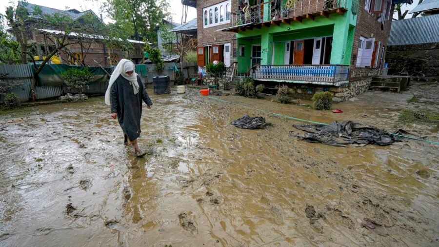
Early flood warning systems at three hydroelectric projects, a GIS-based multi-hazard risk atlas, and stronger disaster-risk planning and regulation – these are some of the major measures the Jammu & Kashmir government is planning as part of its early flood warning systems as it considers ways to ensure sufficient response time in the event of a natural disaster.
Rahul Yadav, Managing Director of the Jammu Kashmir Power Development Corporation (JKPDC), told that tenders have been floated for installation of these early warning systems at the 900-megawatt (MW) Baglihar hydroelectric project over the Chenab river in Ramban district, the 105-MW Upper Sindh hydroelectric project over the Sindh river in Ganderbal district, and the 37.5-MW Parnai hydroelectric project built on the Suran river near Bafliaz in border Poonch district.
The decision forms part of the UT administration’s multi-pronged strategy to strengthen disaster resilience following cloudbursts and floods in J&K, especially in the Chenab Valley region. It also assumes significance in view of the large-scale deaths and widespread devastation caused by recent floods in Nepal, which experts say were triggered by a high-altitude glacial lake outburst on the China border.
Story continues below this ad
The system will involve identifying strategic locations for installing sensors and communication equipment upstream of hydroelectric dams and barrages, providing one to two hours of response time, sources said. To ensure foolproof transmission of data, the system will have sensor redundancy so that, in the event of failure of one sensor, another automatically takes over. The health of instruments, batteries and the communication system will also be monitored in real time, they added.
Significantly, all three hydroelectric projects are located in mountainous regions highly vulnerable to flash floods triggered by cloudbursts, avalanches and glacial lake outbursts at high altitudes.
Kishtwar Deputy Commissioner Pankaj Sharma, under whose jurisdiction the Paddar area falls, said that after last year’s Chishoti flash floods, several studies were conducted by experts from the Department of Disaster Management, Relief, Rehabilitation and Reconstruction (DMRRR).
While the expert teams initially conducted studies on landslide-prone areas across the UT, they later studied GLOFs. Kishtwar, Doda and Ramban districts were placed in the highly vulnerable category for landslides, he added.
Story continues below this ad
Mundiskar lake ‘highly vulnerable’
As far as high-altitude glacial lakes are concerned, the studies have categorised Mundiskar lake in the district as “highly vulnerable”.
Sharma said the Kishtwar district administration sent a Rs 35-crore proposal to the DMRRR for disaster mitigation measures nearly a fortnight ago. The work will start once the expert committee in the DMRRR meets and approves the proposal, he added.
Jammu and Kashmir has seen repeated episodes of flash floods, cloudbursts and landslides in recent years, with the Chenab Valley among the worst affected. At least 50 people were killed and over 100 injured in flash floods at Chishoti following a cloudburst in the Paddar area of Kishtwar last year, while a cloudburst-triggered flash flood in Poonch’s Surankote tehsil in mid-July this year killed at least 17 people and caused large-scale damage to public and private infrastructure.
Since June 1 this year, nearly 35 cloudburst incidents have been reported across the UT, with Kishtwar, Doda and Ramban among the most vulnerable districts.
Story continues below this ad
Last year, the Jammu & Kashmir government, quoting a scientific study by researchers from Kashmir University’s Department of Geo-informatics, had said that five glacial lakes in the Kashmir Himalayas fall in the “very high susceptibility” class for potential glacial lake outburst floods.
Threat to 2,704 buildings, 15 major bridges
Identifying these lakes as Bramsar, Chrisar, Nundgol, Bhagsar and Gangabal, it added that, as per the study, their high susceptibility together threatens 2,704 buildings, around 15 major bridges, segments of road infrastructure and one hydroelectric power plant in their immediate downstream areas.
These were categorised under the “very high susceptibility” class following a study of 155 glacial lakes using hydro-geomorphic indicators, including lake expansion rate, stability of their dams and surrounding conditions, the study added.
Officials said the DMRRR, in a major push to strengthen disaster preparedness in the UT, is implementing a five-pronged strategy across Jammu and Kashmir.
Story continues below this ad
This includes creating a GIS-based multi-hazard risk atlas using digital terrain and elevation modelling in vulnerable areas, enforcing building safety codes, updating district disaster management plans and integrating risk reduction into master plans.
Apart from establishing a dedicated disaster management training institute, it also intends to sign an MoU with the Geological Survey of India for forecasting landslides, besides employing targeted mitigation measures for monitoring GLOFs and stabilising landslide-prone areas.

For man labelled ‘Lashkar worker’, major relief in J&K court
By Sohail Khan · 15 Sep