How Nepal’s terrain leaves it particularly vulnerable to flash floods
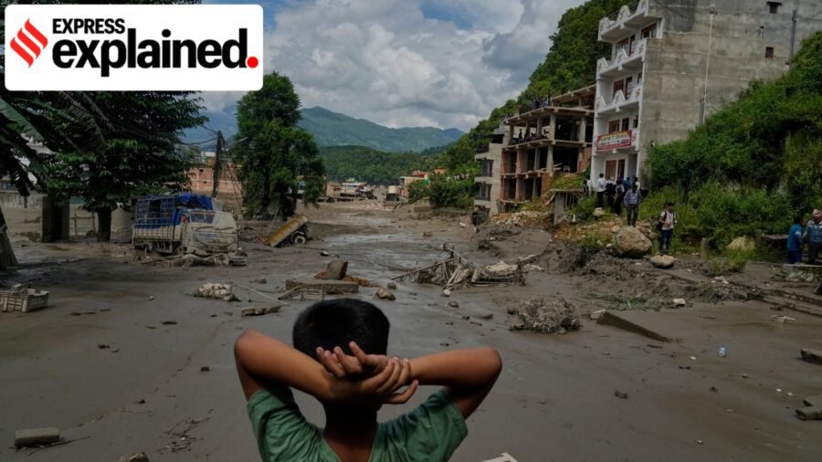
On Wednesday (August 26), floods struck the border of Nepal and Tibet claiming at least 100 lives and leaving many others missing. Of the missing individuals, 105 were Indians.
The flash flood swallowed roads, bridges and houses. It also triggered a mudslide that crippled Gyirong Port — a major crossing point between Tibet and Nepal — while severing power and communications due to the destruction of critical infrastructure.
Last year, a glacial lake outburst flood (GLOF) struck the Bhote Koshi and Lende river corridors. Among the damage caused were four major hydropower plants along the Bhote Koshi river, which were shut down and cut off 8% of Nepal’s total electricity supply.
Story continues below this ad
Pending a formal investigation, official channels have speculated that an avalanche caused upstream due to an earthquake is the cause of this latest flood. What, however, is a flash flood, and how was it caused by an earthquake? How does Nepal’s unique topographic position increase the vulnerabilities faced during such disasters? We explain.
How does a flash flood happen?
A flash flood is a sudden (and oftentimes violent) surge of water that inundates low-lying areas in very small periods of time.
In mountainous terrains, such floods carry greater energy, obliterating all the structures in its path. The sheer velocity of the flood leaves communities that live downstream with little to no warning or window for evacuation.
The latest flash flood instantly destroyed heavy infrastructure like hydropower plants and communications hardware, which essentially cut off affected border areas from the outside world. While the reason for this calamity is yet to be officially stated, official channels are considering the possibility that an avalanche triggered by an earthquake was the catalyst.
Story continues below this ad
How can an earthquake trigger an avalanche?
The peaks of the Himalaya mountains are capped with gargantuan glaciers and precariously balanced rock formations. The incidence of an earthquake disturbs this fragile balance, and when seismic tremors ripple through the terrain, rock, ice, mud and other solids are violently moved around.
According to Reuters, authorities suspect that an ice-rock avalanche was triggered by such an earthquake in the Lhende Khola river. A narrow river, the Lhende Khola was subjected to the bulk of the avalanche plummeting down its streams. Somewhere along the way, the debris formed a dense and temporary dam. In such cases, water backs up rapidly behind this unstable barrier until the constantly increasing pressure gives way to a rupture in the dam wall.
This rupture sends a wall of water in combination with the solid debris from the avalanche hurtling downstream towards settled communities. These mechanics make the danger a dynamic variable. Authorities have alerted that a second flood may be possible due to debris blockage still lodged upstream in the Lhende Khola river.
Nepal’s topographic conditions
Nepal’s extreme topography includes some of the highest peaks on Earth alongside narrow but deep river gorges. This combination creates funnels that naturally accelerate the speed of the water, further increasing its destructive capacities.
Story continues below this ad
While this creates a host of geological complications, some of the immediate hurdles are:
- The naturally rough terrain coupled with a disaster makes emergency response services difficult. Officials stated on Wednesday that rescue helicopters would not be able to land in the affected areas until the floodwater had receded. The narrow nature of habitable valleys also creates highly concentrated settlements. In such cases, even a single flood can geographically isolate such communities from aid.
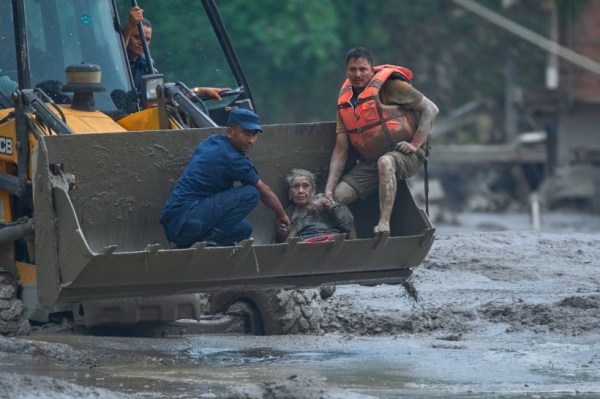 Rescuers use an earthmover to carry a victim of flash flooding to safety along the Trishuli River in Nepal’s Nuwakot district, Aug. 26, 2026.
- The incline and altitude for the flood on its way down also amplify the dangers. As water hurtles down the steep gradients, it also dislodges huge amounts of earth and boulders lying on the riverbed and the banks. This flood sediment has created logistical challenges for the 574 rescue personnel China has deployed to Gyirong port’s land crossing.
Within the geography of the Himalayas, the Lhende Khola is a transboundary river that runs through both Nepal and China. It assumes the role of a high-altitude tributary of the Bhote Koshi river—part of the region’s interconnected hydrology network which includes the Trishuli and Narayani rivers.
All three carve out deep river basins for themselves through the mountains before flowing downstream into the plains. This interconnected flow is why flood alerts were immediately issued in downstream Indian states like Bihar and Uttar Pradesh.
Furthermore, the fast-flowing rivers are highly prized for hydropower generation, drawing foreign investment and workers — such as eight South Koreans who remain unaccounted for after a hydropower plant was struck during the floods.

Across generations, a shared love for coffee — and drinking it together
By Sohail Khan · 26 Sep

Expert Explains | Why the Trump-Xi bonhomie doesn’t mean an end to US and China’s rivalry
By Sohail Khan · 26 Sep