Tropical Storm Edouard expected to become hurricane before Texas landfall: Check map, flood watches and warnings
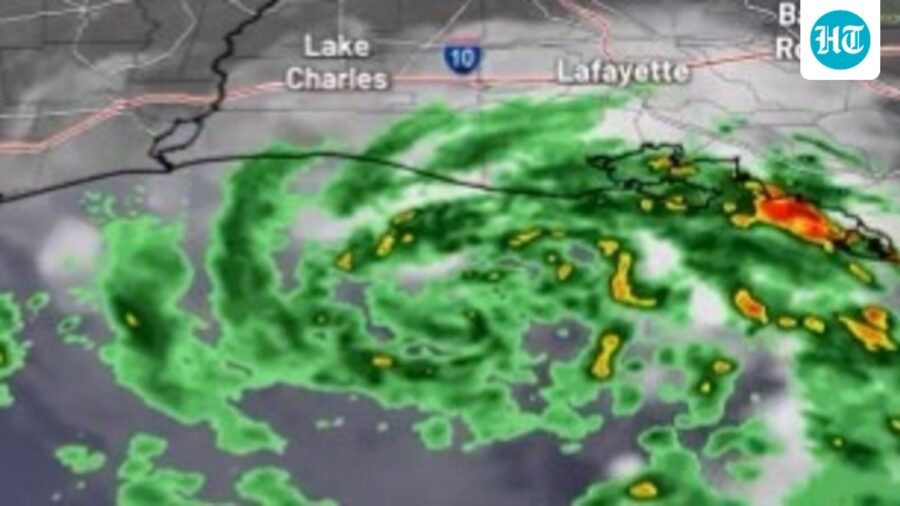
Tropical Storm Edouard is expected to strengthen before reaching the Texas coast, bringing heavy rainfall and potential flooding to eastern Texas and Louisiana.
Updated on: Sep 1, 2026, 17:00:31 IST
Prefer HTon Google
Share via
Copy link
Tropical Storm Edouard has developed in the Gulf, and the National Hurricane Center cautions about major strengthening before its arrival on the Texas coast later tonight.
The storm is expected to be short-lived, it will produce heavy rainfall leading to flooding in parts of eastern Texas and Louisiana, including the Houston metropolitan area . It may also affect regions as far north as Dallas. Moreover. coastal regions could experience storm surges of 3 to 5 feet, along with the possibility of strong winds, The Weather Channel reported.
Edouard may temporarily reach hurricane status just before making landfall.
Deep Dive
Powered ByAsk
On Monday evening, Edouard was classified as the fifth named storm of the 2026 Atlantic hurricane season, having been identified as a tropical depression earlier that same afternoon.
Tropical Storm Edouard: Hurricane watch and warning
A hurricane watch has been declared from High Island, Texas, to Cameron, Louisiana, indicating that winds of 74 mph or greater may occur on Tuesday.
Tropical storm warnings are in effect from Port Bolivar, Texas, to the Vermilion/Iberia Parish Line in Louisiana, signifying that winds exceeding 40 mph are anticipated today. This warning encompasses Chambers County and the Bolivar Peninsula.
A flood watch remains active for southeast Texas, including Houston, until Wednesday morning. There is a potential for flooding due to significant rainfall in these regions.
Additionally, a storm surge warning has been issued from High Island, Texas, to Cameron, Louisiana.
Tropical Storm Edouard approaches Texas: What else you need to know
Tropical Storm Edouard is currently located slightly more than 50 miles south of the southwestern coast of Louisiana, progressing in a west-northwest direction.
Fortunately, Edouard is not anticipated to linger over the warm waters of the Gulf for long, as it is expected to make landfall in eastern Texas on Tuesday afternoon or evening.
Following this, it is projected to continue its inland movement on Wednesday and dissipate by early Thursday.
Wind shear remains relatively low, and the water temperatures in the Gulf are in the upper 80s, both of which are conducive for further development.
The compact nature of this system may enable it to intensify beyond current predictions. However, rainfall is anticipated to have the most significant effect.
Edouard has the potential to briefly reach minimal hurricane status as it approaches land.
Tropical Storm Edouard: What will be the impact?
Certain areas along the upper Texas and southwest Louisiana coasts are anticipated to experience tropical-storm-force gusts for several hours surrounding its landfall on Tuesday. These winds may begin before the morning commute.
Wind gusts exceeding 75 mph could occur within a few hours following landfall, leading to potentially damaging winds in localized areas.
However, the primary concern associated with this system is the heavy rainfall expected, affecting both coastal regions and, to a degree, areas further inland, particularly in eastern Texas.
Generally, rainfall amounts of 3 to 6 inches are anticipated, although the upper Texas Coast may experience up to 9 inches. Certain regions in southwest Louisiana could receive as much as 3 inches of rain.
Localized heavy rainfall may continue with the remnant low on Wednesday, and possibly extend into Thursday in eastern Texas.
Despite the ongoing drought in this region, these intense rain bands could result in flash flooding, particularly affecting areas within the Houston metro region.
See Less