Timber, Plaskett wildfires grow in Monterey County: Alarming warning, evacuation order, shelters, Highway 1 closure
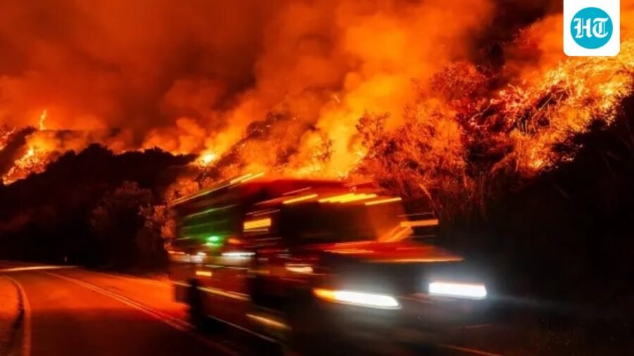
Monterey County is battling expanding wildfires, with the Timber fire at 25,190 acres (22% contained) and the Plaskett fire at 26,734 acres (1% contained).
Updated on: Sep 1, 2026, 21:03:14 IST
Prefer HTon Google
Share via
Copy link
Two major wildfires in Monterey County are continuing to expand as firefighting teams face challenges in controlling both blazes.
The larger of the two, known as the Timber fire, had consumed approximately 25,190 acres by Monday night and was reported to be 22% contained. According to Cal Fire’s incident page, crews are concentrating on strengthening existing fire lines to prevent any further spread of the fire.
Timber, Plaskett wildfires: All on threats and warnings
This fire was initially reported on the morning of August 9, and officials said that it still presents a threat to the Big Sur region and surrounding communities in southern Monterey County. As of Monday night, no new evacuation orders or warnings have been issued, Lookout Santa Cruz reported.
A Cal Fire incident management team, which is a specialized group of emergency responders that offers leadership and coordination during complex incidents, is still overseeing the fire response. Additionally, a crew from the Central Fire District of Santa Cruz County has been deployed to assist with the ongoing efforts.
Know what is closed
The closure of northern Highway 1 is currently situated at Mile Marker 56, immediately south of the Little Sur River, and stretches down to Mile Marker 45, which is positioned just south of Big Sur Deli.
State parks in the Big Sur region continue to be closed, including Point Sur State Historic Park, Andrew Molera State Park, Pfeiffer Big Sur State Park, and Julia Pfeiffer Burns State Park.
Approximately 25 miles to the south, the Plaskett fire has expanded to 26,734 acres as of Monday evening, with only 1% containment reported. Authorities indicate that the fire, which ignited on August 26, is advancing swiftly and is situated in "steep, rugged terrain with thick vegetation," complicating access for ground crews.
According to fire officials, the fire exhibited "continued aggressive growth" on Monday, particularly along its eastern perimeter as flames advanced further into Fort Hunter Liggett.
This region has not seen a significant wildfire in over 50 years, resulting in dense vegetation that has contributed to the blaze as it ravages steep and challenging terrain.
Evacuation orders in Monterey and San Luis Obispo counties
Evacuation orders have been implemented for multiple zones in southern Monterey County, and as of Monday, officials in San Luis Obispo County have also issued evacuation warnings, as stated on the Cal Fire incident page.
In this region of Monterey County, Highway 1 has been closed, beginning at Mile Marker 16.0, located just north of the Pacific Valley Bluff Trailhead. The closure extends to the southern boundary at Mile Marker 2.1, which is situated south of Salmon Creek.
Emergency shelters have been set up at the Carmel Mission Inn and the Veterans Memorial Building in Cambria, as per NY Post.
The cause of the fire is still under investigation.
See Less