Reno Hawk Fire evacuation map: Wildfire spreads near Somersett; Peavine Peak, Verdi, Mogul and Cold Springs on alert
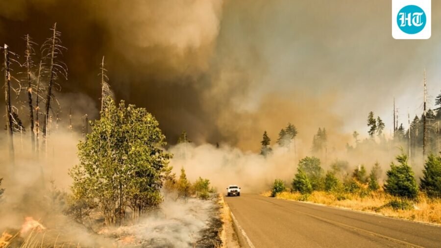
30-acre Cold Creek Trail wildfire in Somersett, Nevada, sparked an evacuation warning Saturday. Smoke was visible near Peavine Road.
Updated on: Aug 23, 2026, 01:47:00 IST
Prefer HTon Google
Share via
Copy link
A large wildfire broke out near the Cold Creek Trail in Somersett, in Washoe County, Nevada on Saturday afternoon. The 30-acre fire, according to Watch Duty, has sparked an evacuation warning for the nearby area.
The smoke from the fire was visible in the nearby area of the Peavine Road.
Reno Fire Evacuation: What We Know So Far
A GO Level evacuation warning was issued in the Somersett Peak and South Mountain areas. The fire is moving west, towards to the Martin Luther King Jr. Highway. To the north, the GO evacuation alert extends to the Sierra Canyon area. The areas south of North Virginia Street were placed under a SET alert, with a potential GO alert coming soon.
The affected areas were mostly north and northwest of Somersett and some areas north of Verdi. It includes Somersett Parkway, Avenida de Landa and Las Brisas Boulevard.
Below is a map of the areas under evacuation from the Hawk Fire. A massive fire response is underway in the area around Somersett.
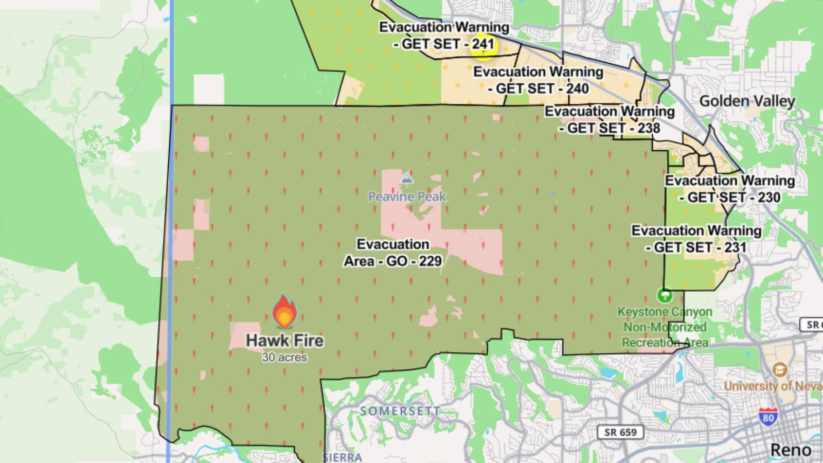
According to the Reno Gazette Journal the fire started around 11:30am EDT, and the incident command has notified that some structures are also threatened.
“While the majority of the evacuation area is unpopulated, residents near the immediate area should remain alert and prepared, as conditions can change rapidly,” said the Washoe County Sheriff’s Office.
“Please use caution in and around the area, remain alert for changing conditions, and be aware of emergency vehicles and personnel responding to the incident.”
Reno Fire Visuals: Large Coul-Like Smoke Across The Sky
Residents and drivers in the area of Somersett and Verdi shared videos and photos of the fire. A large cloud-like plume of smoke can be seen reaching into the sky, visible from even faraway areas.
Here's a video recorded by a resident from very close to the Cold Trail Creek. It shows smoke rising in the area, almost covering the sun.
Here's another video recorded by a user while walking their dog up the Truckee Drive in Reno. "I’m walking my dog up the Truckee River in Reno and another fire just popped off. Northwest of Reno," the user wrote.
Here's another video shared by a resident.
Washoe County is in northwestern Nevada, centered on Reno. It stretches from the California border to the high desert around Pyramid Lake. As a result, multiple people in California also reported seeing the smoke.
It is Nevada’s second-most populous county and is known for Reno’s casinos, the Sierra Nevada landscape, and outdoor recreation around Lake Tahoe and Pyramid Lake.
This story is being updated.
See Less

Trump mocks ‘Sleepy Joe’, then appears to doze off during $15B steel plant announcement
By Sohail Khan · 29 Sep