IMD predicts heavy rain in 5 districts, Yanam today
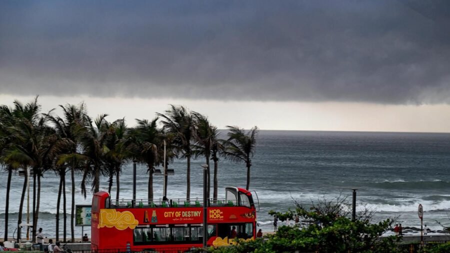
A low pressure area formed over the northwest Bay of Bengal and adjoining West Bengal-north Odisha coasts is very likely to move northwestwards and concentrate into a depression within the next 12 hours, the India Meteorological Department (IMD) said on Sunday.
According to the Cyclone Warning Centre, Visakhapatnam, the system, aided by an upper air cyclonic circulation, had first formed at 5.30 a.m., strengthened into a well-marked low pressure area by 2.30 p.m., and continued to persist over the same region at 5.30 p.m.
The Andhra Pradesh State Disaster Management Authority (APSDMA) said winds of 40-50 kmph, gusting to 60 kmph, were likely to prevail over the northwest and west-central Bay of Bengal and along the north Andhra Pradesh coast till Tuesday. The sea would remain rough, with a possibility of the waves surging, the authority said, advising fishermen against venturing into the sea. Those already out at sea were asked to return to the shore immediately.
The IMD has forecast heavy rainfall at isolated places over Srikakulam, Vizianagaram, Parvathipuram Manyam, Anakapalli, and Alluri Sitharama Raju districts, as well as Yanam, over the next 24 hours.
Light to moderate rain
On Monday, thunderstorms accompanied by lightning, along with light to moderate rain, are likely at isolated places in Srikakulam, Vizianagaram, Polavaram, Visakhapatnam, Eluru, Nellore and Tirupati districts, APSDMA said. Light rain is likely at a few places in Parvathipuram Manyam, Alluri Sitharama Raju, Anakapalli, Kakinada, Konaseema, East Godavari, West Godavari, Krishna, Markapuram, Prakasam, and Chittoor districts.
Meanwhile, on Tuesday, light to moderate rain is likely over the districts of north coastal Andhra Pradesh, APSDMA said, appealing to the public to remain alert. Strong surface winds of 40-50 kmph are also expected at isolated places over coastal Andhra Pradesh, Yanam, and Rayalaseema over the next two days.
The advisory against venturing into the sea, currently limited to the north Andhra Pradesh coast and Yanam, will extend to south coastal Andhra Pradesh from Tuesday. Sea conditions are expected to be rough to very rough off the West Bengal, Odisha, and north Andhra Pradesh coasts until Tuesday.
The data released by the Regional Meteorological Centre, Amaravati, for Sunday showed Tirupati recording the day’s highest maximum temperature in the State at 38.5°C, 3.5°C above normal, followed by Kavali at 38.3°C and Bapatla at 37.9°C. Among the 21 stations monitored, only Tuni recorded rainfall, at 8 mm. Relative humidity was highest at Visakhapatnam, at 80%.
The bulletin also flagged swell surge alerts for the coastal districts of Srikakulam, Visakhapatnam, Vizianagaram, East Godavari, Krishna, and West Godavari, with wave heights of up to 1.4 metres forecast through Sunday evening. Ocean current alerts were issued for the Krishna and Nellore coasts, with harbour and marine operations advised to exercise caution.
The Chief Secretary, the Commissioner for Disaster Management, and district collectors across the State have been alerted, along with All India Radio stations and railway authorities, as a precautionary measure.

‘My gesture during Assembly speech inadvertent’: Tamil Nadu CM Vijay
By Sohail Khan · 8 Sep

Tamil Nadu Assembly Budget session concludes after 28 days
By Sohail Khan · 8 Sep